
|
|
#1
|
||||
|
||||
|
well the boss has a vacation house in reedville, va on the chesapeake bay. we are going fishing there in october, and i am taking my boat. it is a 5 hour drive from here and I dont want to haul the old girl that far.
So my question is...... can I do any of these courses??? I figured you would be the one to know ;) How long do you think it would take at 30 mph on a calm day??? 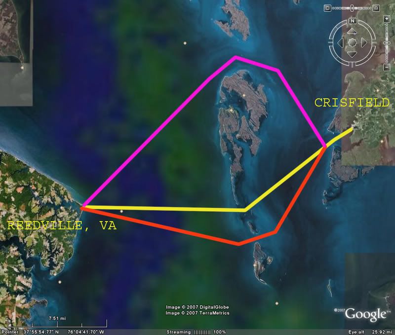
__________________
 CY 1984 V20 STEP LIFT I/O 470 MERCRUISER Wheeling, WV CY 1984 V20 STEP LIFT I/O 470 MERCRUISER Wheeling, WV

|
|
|


 Threaded Mode