
|
|
#1
|
||||
|
||||
|
If today and tonite don't keep ya home, check out Thurs forecast... THIS AFTERNOON NE WINDS 20 TO 30 KT...EXCEPT FAR SE PORTION TO 35 KT. SEAS 8 TO 12 FT...EXCEPT S PORTION 12 TO 16 FT...HIGHEST FAR SE. TONIGHT NE WINDS INCREASING TO 25 TO 35 KT...EXCEPT SE PORTION TO 35 TO 45 KT. SEAS BUILDING TO 11 TO 16 FT...EXCEPT S PORTION 16 TO 21 FT...HIGHEST FAR SE. RAIN DEVELOPING. THU WINDS BECOMING E TO NE 30 TO 40 KT. SEAS BECOMING 14 TO 20 FT LATE...HIGHEST SE. AREAS OF RAIN OCCASIONALLY REDUCING VSBY BELOW 1 NM. THU NIGHT E TO SE WINDS DIMINISHING TO 20 TO 30 KT. SEAS SUBSIDING TO 12 TO 16 FT. RAIN CHANGING TO SCATTERED SHOWERS. FRI E TO SE WINDS DIMINISHING TO 15 TO 20 KT. SEAS SUBSIDING TO 9 TO 12 FT LATE. SAT SE WINDS DIMINISHING TO 10 TO 15 KT...BECOMING SW LATE. SEAS 8 TO 11 FT WITH SE SWELL...HIGHEST E. SUN 
__________________
'74 V-20/ BF 150 '95 V-21/ BF 150 '84 V-20/ 200 2.4 Merc '87 V-20/'18 F150 Yamaha 

|
|
#5
 09-24-2008, 10:02 PM
|
||||
|
||||
|
Its gonna get real good after this fan shuts off.
__________________
 1994 Wellcraft V21
|
|
#6
09-25-2008, 06:52 AM
|
||||
|
||||
|
Quote:
...are ya goin'??...
__________________
'74 V-20/ BF 150 '95 V-21/ BF 150 '84 V-20/ 200 2.4 Merc '87 V-20/'18 F150 Yamaha
|
|
#7
09-25-2008, 08:31 AM
|
||||
|
||||
|
It may get a little more interesting. I thought that originally they were calling for the low to move northward toward NC, but now...
A well-defined surface low pressure system centered about 180 miles southeast of the South Carolina-North Carolina border is moving slowly westward. Satellite images and surface observations indicate that the low is still embedded within a frontal zone and has not yet acquired tropical characteristics. However there is still a possibility that this system could develop into a subtropical or tropical cyclone later today. Regardless of whether or not this occurs...strong winds...coastal flooding...high surf...and dangerous rip currents will continue along portions of the U.S. East Coast during the next couple of days. We'll definitely be staying in the creeks this weekend.
|
|
#8
09-25-2008, 08:50 AM
|
||||
|
||||
|
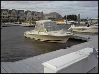
well I went over last night and wrapped mine up like a christmas present. She is all tucked in and ready to handle whatever this storm brings.
__________________
 CY 1984 V20 STEP LIFT I/O 470 MERCRUISER Wheeling, WV CY 1984 V20 STEP LIFT I/O 470 MERCRUISER Wheeling, WV
|
|
#9
09-25-2008, 08:51 AM
|
||||
|
||||
|
today
e winds 15 to 20 kt with gusts up to 30 kt. Seas 5 to 8 ft. tonight e winds 15 to 25 kt...becoming 15 to 20 kt in the late evening and early morning...then increasing to 20 to 25 kt after midnight. Gusts up to 35 kt. Seas 7 to 10 ft. A chance of rain after midnight. fri e winds 20 to 25 kt. Gusts up to 35 kt until late afternoon. Seas 9 to 12 ft. Rain. Patchy fog. Vsby 1 to 3 nm. fri night e winds 15 to 20 kt...diminishing to 10 to 15 kt in the late evening and overnight. Seas 9 to 12 ft. Rain. Patchy fog. Vsby 1 to 3 nm. sat ne winds 15 to 20 kt...increasing to 20 to 25 kt early in the afternoon. Gusts up to 35 kt. Seas 8 to 11 ft. Rain in the morning...then rain likely in the afternoon. Patchy fog. Vsby 1 to 3 nm. sat night n winds 20 to 25 kt with gusts up to 30 kt... Becoming w 15 to 20 kt with gusts up to 25 kt in the late evening and early morning...then becoming sw 10 to 15 kt with gusts up to 20 kt after midnight. Seas 9 to 14 ft...subsiding to 8 to 11 ft after midnight. A chance of rain. Patchy fog. Vsby 1 to 3 nm. sun sw winds 15 to 20 kt...becoming w in the late evening and overnight. Gusts up to 25 kt. Seas 6 to 9 ft...subsiding to 4 to 7 ft in the late evening and overnight. A chance of showers. Patchy fog. Vsby 1 to 3 nm until late afternoon.
__________________
1986 V20  Old Fishermen never die, we just SMELL that way!!
|
 |
|
|


 Linear Mode

